
Over Briefkaarten
Aangeboden door
Over dit ontwerp
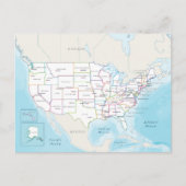
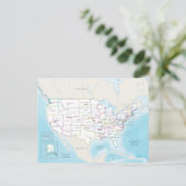
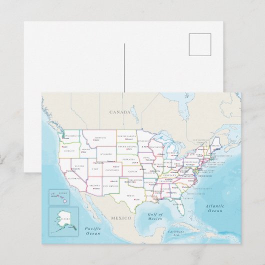
Digital political map of the United States. Briefkaart
This image is a clean, detailed political map of the United States showing all 50 states outlined in various colors, with each state labeled by name and marked with a red star indicating its capital city. Set against a light geographic backdrop that includes major surrounding waters such as the Pacific Ocean, Atlantic Ocean, and Gulf of Mexico, as well as neighboring countries Canada and Mexico; in the lower corners, inset maps highlight Alaska and Hawaii for clarity, displaying their shapes, boundaries, and capitals (Juneau and Honolulu), creating a clear, visually organized reference map of U.S. geography.
Store
Klant beoordelingen
4.5 van 5 sterren beoordeling28 aantal beoordelingen
28 Reviews
Beoordelingen voor identieke producten
3 van 5 sterren beoordeling
Door Anoniem13 juli 2024 • Geverifieerde aankoop
Briefkaart, Maat: Standaard Briefkaart, Papier: Signature Mat, Enveloppen: Geen
It's a nice picture, however it doesn't touch the edges of the card. Plus, the cut after print is done poorly. It's printed nicely, but the finish isn't good
5 van 5 sterren beoordeling
Door M.18 mei 2022 • Geverifieerde aankoop
Briefkaart, Maat: Standaard Briefkaart, Papier: Signature Mat, Enveloppen: Geen
Zazzler recensent programma
It is beautiful! Now I want to visit this museum. Perfect. Love the texture of the paper.
4 van 5 sterren beoordeling
Door Anoniem13 juli 2024 • Geverifieerde aankoop
Briefkaart, Maat: Standaard Briefkaart, Papier: Signature Mat, Enveloppen: Geen
Again, edges poorly cut. Print OK, badly cut edges
Tags
Andere Info
Product ID: 256289103180271933
Ontworpen op: 16-11-2025 9:37
Rating: G
Recent bekeken items